[ad_1]
The trail is short but steep, and it smells of sage. A few hundred feet below, I see moms with strollers on a path beside the San Diego River. Above, I see granite cliffs and hear the hollers of unseen climbers.
“Rope!” says one.
“Hey,” says another. “There’s a ram’s horn down here!”
This is the Climbers Loop Trail at Kwaay Paay Peak, one of my new favorite spots in the biggest city park that you’ve never heard of: Mission Trails Regional Park in San Diego.
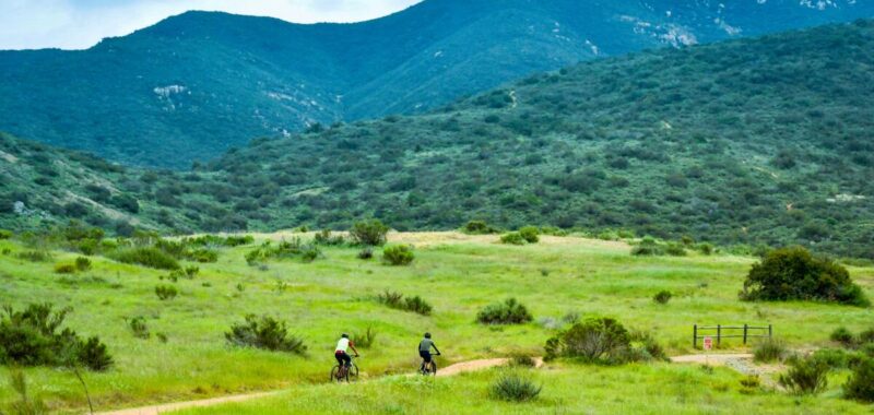
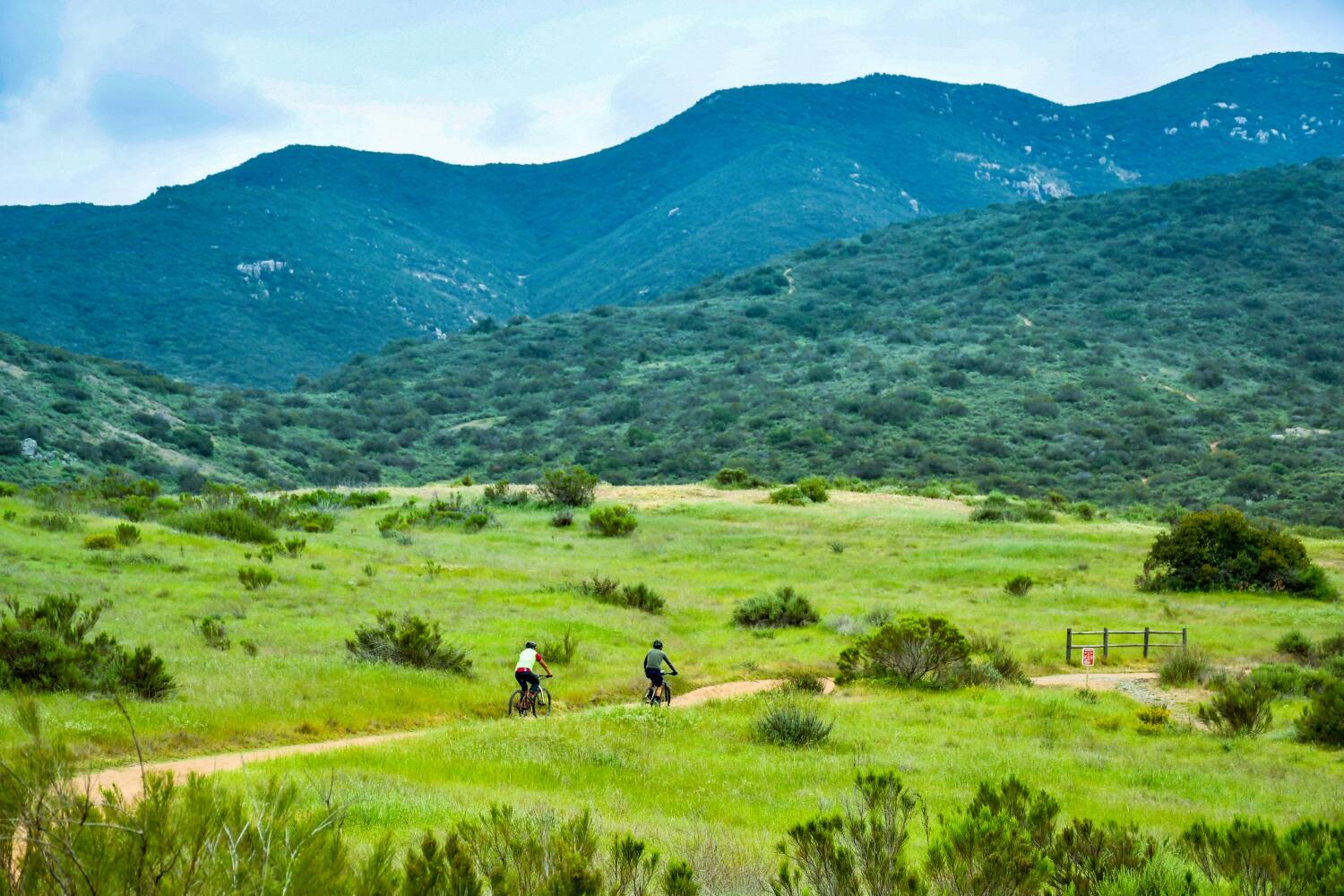
No, this park is not downtown like its more famous sibling, Balboa Park. But Mission Trails, eight miles northeast of downtown and 15 miles from the beach, is the biggest city-owned park in California. Along with the trickling river and a dam that dates to the early Spanish missionary days, the landscape includes 65 miles of trails on more than 8,000 acres of rugged mountains, hills and valleys.
It looks like a healthy slice of Arizona, and it covers more territory than Balboa Park, L.A.’s Griffith Park, San Francisco’s Golden Gate Park and Irvine’s Great Park combined.
Also, it used to be my backyard. Throughout my teen years, my family lived on a cul-de-sac at the base of Cowles Mountain, the highest summit in the park and the city. The chaparral began 40 feet from my back door.
Almost as often as we loitered at the mall and ogled the guitars at American Dream Music, my friends and I wandered the mountain slopes, wading through the sagebrush and nosing around the granite boulders, sidestepping coyote scat, and generally walking that fine line between high jinks and delinquency.
Officially, the park was younger than we were, having been established in 1974. But it contained such deep and obvious history, even the teenage me could appreciate it.
For millennia before the Spanish showed up and built a dam to serve their first Alta California mission, the Kumeyaay lived in these hills.
During World War I, the Army used the area, known as Camp Elliott, for tank and artillery training. During World War II, the Marines did the same, leaving plenty of ordnance behind — including some that exploded in 1983, killing two boys. (Even now, after various cleanup efforts, signs warn that unexploded shells “might still exist.” If you see something suspicious, report it and don’t touch it.)
Once military officials decided they didn’t need the land, local leaders stepped in and began putting together a park in the 1960s and ‘70s. The city added Cowles Mountain in 1974. The visitor center followed in 1995. The Cedar fire of 2003 burned about 2,800 acres, which have long since regrown.
I had a great time brushing up on that history and wandering Mission Trails for two days this spring — my longest spell in those hills since high school. Overnight I slept in a cabin at Santee Lakes Recreation Preserve, about two miles east of the park, where several recycled-water lakes are surrounded by well-kept fishing spots, walking paths, playgrounds and a campground.
Also, I have to note that I was in Mission Trails for more than three hours before I saw any graffiti. I’m not sure that’s doable in Griffith Park.
It’s unlikely many people outside San Diego County know this place exists. But local hikers and birders turn out in force. Climbers like Kwaay Paay Peak (elevation: 1,194 feet) and mountain bikers, equestrians and anglers have their own favorite park territories. You can camp at Santee Lakes or, on weekends, put up a tent in the park’s Kumeyaay Lake campground.
Mission Trails has the highest peak in the city (Cowles Mountain at 1,591 feet). It has the compact Kumeyaay Lake and the larger Murray Reservoir (a.k.a. Lake Murray), which has fishing, kayaking and canoeing about three miles south of the park visitor center.
But many would say the park’s Main Street is Father Junipero Serra Trail, a paved path that runs alongside the San Diego River, mountains rising on either side.
“I just started coming in the last few weeks,” hiker Sumeya Sayd, 23, told me one day as she stepped off the Serra Trail. Like me, she had hiked Cowles Mountain as a youth and overlooked the rest of the park.
Now, inspired by a Muslim American Society group chat, Sayd has been hiking the Serra and Climbers Loop trails more often and thinking about the Mission Trails five-peak challenge — five peaks in the park, each over 1,000 feet.
You can walk or pedal on the Serra Trail, which stretches 2.6 miles and connects the park visitor center to the Old Mission Dam. (Ordinarily, there’s a lane open to vehicular traffic, but because of a sewage-line improvement project, cars will be banned until summer of 2028.)
“This is Desert Wishbone-bush,” I overheard Justin Daniel saying one day along the trail. Daniel, who held aloft a purple flower, was leading a group of about 15 people from the California Native Plant Society.
Soon the group moved on to the California Buckwheat and Daniel added that “we have the most native plants in California for one county,” along with “more native bees than you can shake a stick at.”
How urban is this urban park? Not very. No museums, no zoos, no restaurants. Still, its busiest trail gets an estimated 780,000 hikers a year. That’s the route to the top of Cowles Mountain from Navajo Road and Golfcrest Drive.
When I lived in the neighborhood, many people still called Cowles Mountain “S Mountain,” because just about every fall from the 1930s into the 1970s, San Diego State freshmen used lye and white paint to make a big S near the top, 400 feet high and visible for miles.
Now the S is long gone, but through the years I’ve seen foot traffic grow. I’ve hiked it solo, with my daughter and with a friend facing a profound loss. Even though the route to the top from the Golfcrest trailhead is just 1.5 miles, every time it’s a bit more challenging than I expect — 950 feet of elevation gain, irregular steps, crumbling rocks. In the old days, I used to get up and down in 90 minutes. Nowadays, my knees complain and the round trip takes two hours.
Fortunately, the view from the top still hits me like a surprise every time: the hills of Mexico to the south, the coastline to the west, the miles of undeveloped slopes and valleys to the north. In a perfect hiker’s world, maybe there would be no line of utility towers slicing through the Fortuna Mountain portion of Mission Trails and no humming radio towers atop Cowles Mountain. But this is a city park after all. In this vast expanse of nature, that’s easy to forget.
Where to hike
Mission Trails Regional Park has nearly 65 miles of trails. Here are some to try.
- If you’re looking for an easy hike and you’re a newbie, start with the long, flat 2.6-mile Father Junipero Serra Trail. Two other easy routes, well suited to kids, are the Kumeyaay Lake Nature Trail (1 mile around the lake; full of birdsong in the mornings) and the 1.5-mile Visitor Center Loop Trail.
- For a longer, mostly flat hike with ample shade, try the park’s Oak Canyon Trail, where a little seasonal waterfall materializes among the rock formations near the far end of the 3.4-mile out-and-back route. That trail has only 240 feet of elevation gain; park rangers call it a “moderate” challenge.
- It’s 1.5 miles to the top of Cowles Mountain from the trailhead at Golfcrest Drive and Navajo Road. If you start instead at Big Rock Park in Santee, it’s a 2.5-mile climb to the top. Rangers classify both routes as difficult.
- For a stiffer challenge, you can try climbing to the South Fortuna or North Fortuna peaks. (Distances vary, depending on route). Also, there’s the brief, steep Climbers Loop Trail (rated difficult, with 400 feet of altitude gain in a 1-mile round trip).
Down the road, there may be new challenges, because the park is still growing. In the last year, Mission Trails Regional Park Foundation executive director Jennifer Morrissey said, the park has added more than 100 acres through a pair of acquisitions at its northern edges. Eventually the park may also add a safe river-crossing near the visitor center — a possibility rooted in tragedy. In early 2021, 21-year-old trailrunner Max LeNail died in a sudden storm while trying to cross the San Diego River near the visitor center. His family is hoping to build a footbridge in his memory, but for now, the nearest crossing is several miles away.
Where to stay
- The Kumeyaay Lake Campground (2 Junipero Serra Trail, San Diego; [619] 668-2748) is part of Mission Trails Regional Park. It includes 46 dry/primitive campsites, open Friday and Saturday nightly only. No RV hookups. Rates begin at $26 nightly.
- Santee Lakes Recreation Preserve (9310 Fanita Parkway, Santee; [619] 596-3141) includes 290 RV spots, about 12 tent-camping sites and 10 cabins. The RV and tent camping spots rent for $62-$111 nightly. Cabins go for $137-$265. There’s plenty of fishing and boating, but no swimming in the recycled water of the lakes. The preserve has a space set aside for a lakefront restaurant with ample deck, but two concessionaires have closed there since 2021 and 2024. Preserve management has said another restaurant will open soon.
[ad_2]
Source link